|
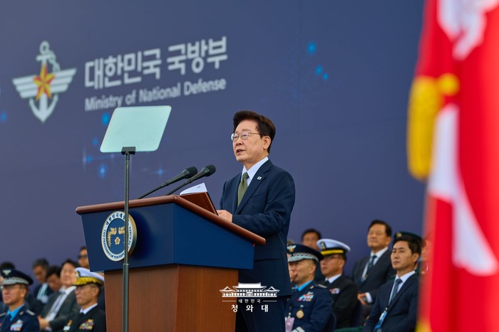
▲ President Lee Jae-myung delivers a speech on Armed Forces Day, October 1. ©성남피플
|
South Korea, North Korea and the UN Command each have their own truth. The line needs to be redrawn through dialogue.
At about 10:50 a.m. on September 21, a suspected landmine went off in the western sector of the Demilitarized Zone (DMZ), in an area guarded by the South Korean Army's 25th Infantry Division. Three soldiers were wounded, and one of them lost a foot at the ankle. The troops were clearing a new patrol route because thick vegetation and other changes in the terrain had made the old one unusable. About 58 seconds after the first blast, a second explosion seriously wounded the commander who rushed in to help. The soldiers then cleared an escape path by scraping the ground with pickaxes, five centimeters at a time. About one meter from the blast crater, they found what appeared to be a wooden-box anti-personnel mine.
The South Korean military said the blast happened about 10 meters south of the Military Demarcation Line (MDL). On September 30, it said North Korean troops had crossed the MDL about 20 times in August and about 30 times in September. The same day, the United Nations Command (UNC) said it had found a North Korean anti-personnel mine south of the line. The Joint Chiefs of Staff said that if the mine is confirmed to be North Korean, "all responsibility lies with North Korea."
North Korea tells the opposite story. In a statement on September 29, Kim Yo Jong, vice department director of the Workers' Party of Korea, called the incident a "self-staged farce." She said North Korean troops had "never once crossed the border line." She also called the North's border fortification work a "legitimate exercise of sovereignty." She warned that if South Korean forces fire live rounds instead of warning shots, the North will "retaliate immediately and mercilessly."
What Did the UN Command Do?
Kim Jong-hoon, leader of the Progressive Party, raised these questions in a Facebook post on October 1, Armed Forces Day. The post was titled "The Landmine Incident: Questions the UN Command Must Answer." He said the operation was meant to open a new patrol route so that the UNC and South Korean forces could jointly inspect terrain changes in an area where mines were suspected. That is why the soldiers had to go about 200 meters off the existing route and come within 10 meters of the MDL. He noted that the area had not been maintained for decades, that no one knew how many mines were buried there, and that the thick brush made it hard even to use mine detectors.
Kim also pointed out that in June the UNC had publicly said North Korea did not violate the Armistice Agreement by laying defensive mines north of the MDL. The accident happened just three months later. "Who assessed and approved the safety of this operation?" he asked. He said the UNC has used broad powers to block Tamiflu shipments approved by the South Korean government as humanitarian aid to the North, to deny a cardinal's visit to Panmunjom, and to refuse DMZ access to officials including the first deputy director of the National Security Office. Yet, he asked, what responsibility has it taken for the safety of South Korean soldiers? "If it cannot manage the area properly," he wrote, "it should simply hand over control."
A 1 mm Pencil Stroke Becomes 50 Meters on the Ground
If South Korea, North Korea and the UNC are each telling "their own truth," only one conclusion follows. They are using different reference lines for the MDL.
According to a 2019 paper by Kye Yong-ho, a military expert and former Marine officer, today's MDL was drawn during the armistice talks in July 1953. Representatives of the UNC, North Korea and China traced it over and over on a 1:50,000 paper map with pencils, ballpoint pens and old fountain pens. If a pencil line is about 1 mm thick, it covers about 50 meters on the ground. That means a 50-meter margin of error is built into a single stroke.
The parties also use different reference standards, and some observers say there are effectively four different lines. The South Korean military relies on coordinates digitized by the Ministry of National Defense in 2015 and on the positions of the MDL markers. The UNC uses GPS-based digital coordinates. The two sets of coordinates reportedly disagree at about 60 percent of points, and in some places they are tens of meters apart from north to south. A mine that went off 10 meters south of the line by one standard could be on North Korea's own side by another.
Arguing Over the Line Will Not Settle It
The exact location of the MDL has been left unresolved for more than 70 years since the armistice. It has now become a variable that threatens peace on the Korean Peninsula, because North Korea has begun its "border fortification" project. As the North builds barriers and lays mines, the line is hardening in place. South Korean forces treat these moves as incursions and fire warning shots. Soldiers are getting hurt in between.
Arguing over who crossed a pencil line with a 50-meter margin of error will not lead to a conclusion. What remains is for the two Koreas to sit down again and either redraw the MDL or designate the most dangerous stretches as peace zones. The UNC should also take responsible part in that process instead of simply holding on to its authority. Young soldiers' lives cannot keep depending on a pencil line drawn 70 years ago.
-By Kim Young-wook